




Outdoor Network
October 15, 2026
Outdoors network
Hiking trails:
The trail network is open.
Mountain bike trails:
The trail network is closed for the season.
To view trail conditions, scroll down.
Trail Map
To view the hiking trail map, click here.
Reminder
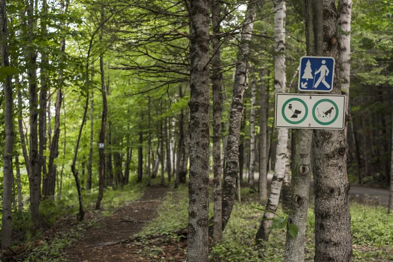
Please note that dogs are allowed, but must be kept on a leash on the trails.
Rain on the Network
When the network receives heavy rain, it must be closed to prevent the trails from being used and damaged, as the ground is softened and more fragile. Therefore, a delay may be necessary before the trails reopen following heavy rain.
Private Land
Many trails in the network pass through private property. Therefore, not all winter trails for cross-country skiing and snowshoeing are used in the summer for hiking and mountain biking. Please check the trail conditions below to see which trails are part of the network during the summer season.
| Lodges | Services | Activities | Status | Opening |
| Chalet Bellevue |
    |
 |
 |
9:00 - 16:00 |
| Parc Basler |
 |
|
 |
9:00 - 17:00 |
| Camping cabines Sommet Morin Heights |
|
|
|
9:00 - 18:00 |
| Parc des Bouleaux |
|
|
|
9:00 - 17:00 |


| Activities | Nomber of tracks | Total length |
| Mountain bike | 0 | 0 km |
| Hiking | 19 | 19.75 km |
| Hybrid bike | 0 | 0 km |
| No | Trail | Level | Length | Type | Dir | Status | Notes |
| Basler Park sector | |||||||
| Bunny Hop |
 |
0.5 km |
 |
 |
 |
||
| 11 | Chickadee |
 |
2.5 km |
|
|
|
closed from Creek Loop to Sommet parking lot |
| 09 | CN |
|
2.2 km |
|
|
|
|
| JCT 11-9 | JCT Chickadee-CN | 0.3 km |
|
|
|
||
| 06 | Lac Lefebvre |
|
0.2 km |
|
|
|
|
| 20 | Lavabo |
|
1.1 km |
|
|
|
|
| Le Labyrinthe |
|
0.6 km |
|
|
|
||
| 22 | Les Pruches | 0.2 km |
|
|
|
||
| Les Sauts |
|
0.3 km |
|
|
|
||
| 18 | Lollipop |
|
2.2 km |
|
|
|
|
| 21 | Rockcliff |
|
2.8 km |
|
|
|
|
| 19 | Sizzler |
|
0.3 km |
|
|
|
|
| Traverse 1 |
|
0.1 km |
|
|
|
||
| Bouleaux Park sector | |||||||
| 17 | Bouleaux | 0.7 km |
|
|
|
||
| 15 | L’Aventurier | 1.3 km |
|
|
|
||
| 12 | L’Enfilade | 0.9 km |
|
|
|
||
| 13 | Le Couloir | 0.7 km |
|
|
|
||
| 14 | Le Parcours du Loup | 2 km |
|
|
|
||
| Other trails | |||||||
| Castel-Marie walking trail | 0.85 km |
 |
|
|
|||


| No | Trail | Level | Length | Type | Dir | Status | Notes |
| Sommet Morin Heights sector | |||||||
| 05 | Érablière | 0.75 km |
|
|
|
||
| 29 | Creek Loop |
|
km |
|
|
|
|
| 24 C | La Cour d’École |
|
km |
|
|
|
|
| 24 A | La Cour d’École |
|
km |
|
|
|
|
| 24 B | La Cour d’École |
|
km |
|
|
|
|
| 22 | Return to sender |
|
km |
|
|
|
|
| 26 | Roller coaster |
|
km |
|
|
|
|
| 28 | Sunset boulevard |
|
km |
|
|
|
|




Photo Galleries


The Town Hall is opened from
Monday to Thursday
8:30 to 12:00 and from
12:45 to 16:30, and Friday
from 8:30 to 12:00
567, chemin du Village
Morin-Heights (Québec)
J0R 1H0
Telephone : 450 226-3232
Fax : 450 226-8786
municipalite@morinheights.com